This wizard appears when you click Insert > Map > Google Map on the menu bar, click the Insert Google Map button  on the Insert toolbar, or drag Google Map from the Toolbox panel into a report or library component. It helps you to insert a Google map into a report or library component, and consists of the following screens:
Back
Goes back to the previous screen.
Next
Goes to the next screen.
Finish
Finishes creating the Google map and closes this dialog.
Cancel
Does not retain changes and closes this dialog.
Help
Displays this help document.
The Data screen differs with report type: page report, or web report/library component.
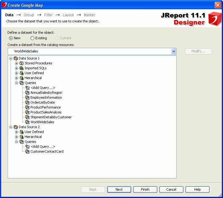
Specifies the dataset that you want to use to create the Google map. See the screen.
Define a dataset for the object
Specifies the dataset on which the Google map will be built.
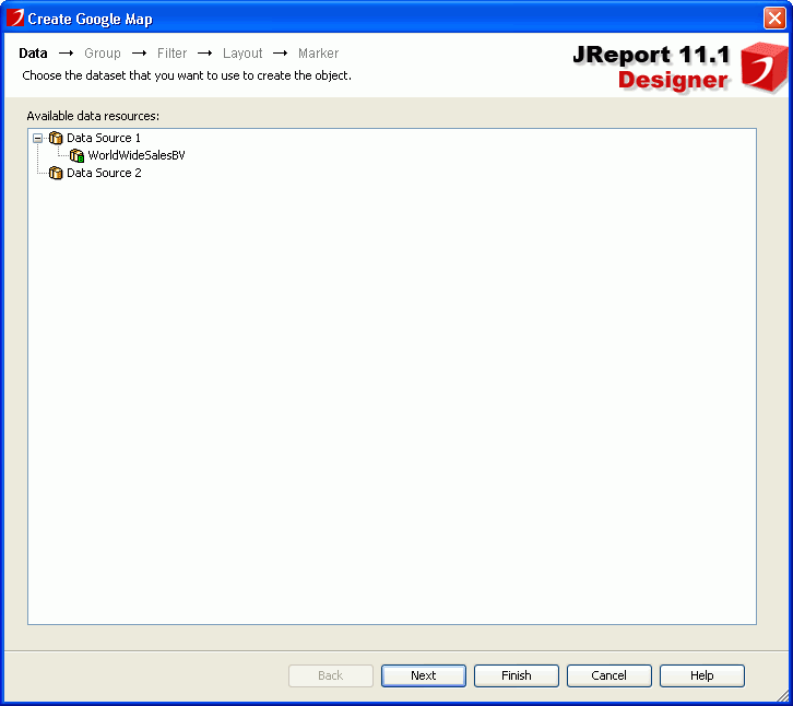
Specifies the data source that you want to use to create the Google Map. See the screen.
Available data resources
Lists all the business views in the current catalog. Specify the one you want to use.
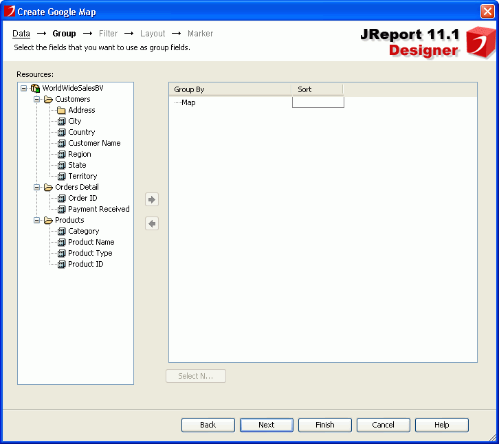
Specifies the data fields that are used to group the data in the Google map. See the screen.
Resources
Lists all the available data resources.

Adds the selected field as the group by field in the Google map.

Removes the selected group by field that is not required.
Group By
Lists the fields that are used to group data in the Google map.
Sort
Specifies how groups at the specific group level will be sorted.
For example, if you placed a field named Region for grouping, and this field contains all 50 states of the United States; and if you want to see the data between Maryland (MD) and New York (NY), you can define the criteria by selecting the between operator to further define your grouping information.
Special Function
If the group by field is of Numeric/String/Date/Time type, you can select a special function for the field in the Special Function column to further specify to which level the data will be grouped by.
If Customize is selected, the Customized Function dialog will be displayed, in which you can set the function by your own.
Sort Group By
Specifies how to sort the groups. Activated only when you have clicked Sort Group By from the Sort column to define the sorting manner of groups for the selected group level.
Special Group
Specifies how to group your information. Activated only when you have clicked Special Group from the Sort column to define a special group.
Select N
Opens the Select N dialog to specify the Select N condition.
Group Filter
Opens the Group Filter dialog to specify the group filter condition.
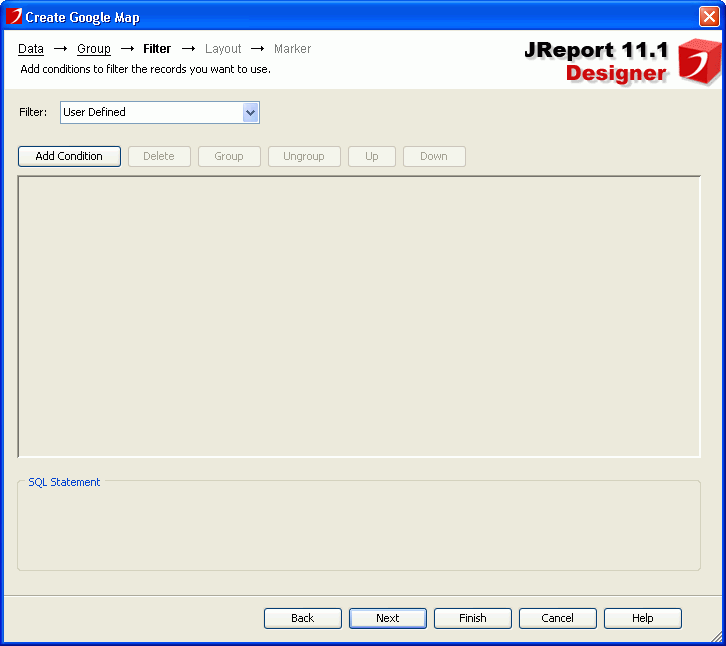
Specifies to filter the data used in the Google map. See the screen.
Filter
This option is available when creating a Google map in a web report or library component. It lists all the predefined filters of the specified business view. Select one from the drop-down list to apply, or select User Defined and define a new filter according to your requirements.
For details about the other options in the screen, see Edit Filter dialog.
Specifies the layout of Google map elements. See the screen.
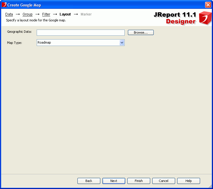
Geographic Data
Specifies the geographical data for the Google map with an XML file. If the XML file that you specify does not exist it will be created in the <install_root>\gisinfo directory. The geographic data XML file is used to map the geographic latitude and longitude coordinates from Google Maps based on the location information specified for each group in the Marker tab. When the location information key string of a group value matches the "nm" field in the XML file, you will get the related latitude and longitude value for this group value.
You can also import an XML file which contains predefined geographic data including latitude and longitude for the specific "nm" field. By default, the XML file is located in the <install_root>\gisinfo directory, if not, the file will be copied to this directory after it is imported. When you publish the report from Designer you can specify the gisinfo files to publish to the Server from the Geographic Information tab.
If you do not publish the geographical information it will be created automatically when you first run the report.
Map Type
Specifies the type for the Google map from the drop-down list.
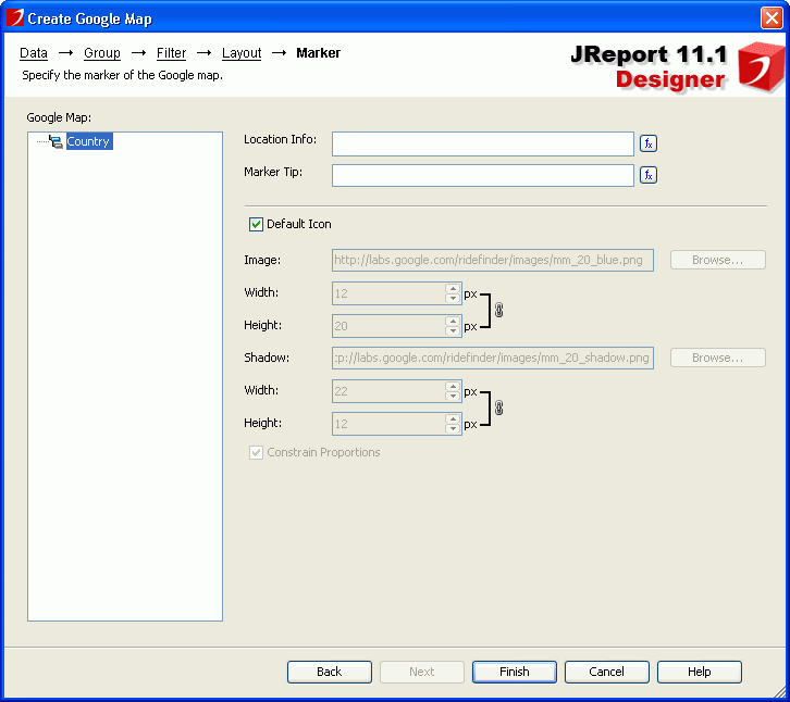
Specifies properties of the markers bound with the group levels. See the screen.
Google Map
Lists all group levels defined for the Google map.
Location Info
Specifies the mapping location of the marker for the selected group level. For each group level that you want to show on the map, specify a DBfield or formula that contains the value matching the "nm" field in the geographic data XML file used by Google map. For example you may group by State and City. For City, you would want to use a formula (fCityState) that concatenates city and state so Google Map knows which city to use such as Portland OR or Portland ME.
Marker Tip
Specifies the tip information when you hover the mouse on the marker at runtime.
Default Icon
Specifies whether to apply the default settings to the icon of the marker.
Image
Specifies the image of the marker. Input the URL for a web image or click Browse button to specify a local image. Available only when Default Icon is unchecked.
Shadow
Specifies the shadow image of the marker. Input the URL for a web image or click Browse button to specify a local image. Available only when Default Icon is unchecked.
Constrain Proportions
Specifies whether to change the width and height for the marker image/shadow at the same time in a certain proportion. If checked, when the width/height is changed, the height/width will also be changed in a certain proportion.
Web Behaviors
Specifies some web behaviors to the marker.